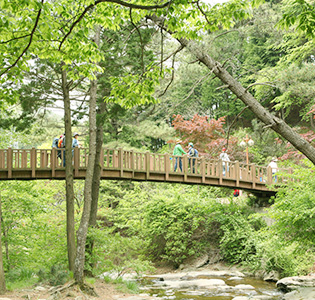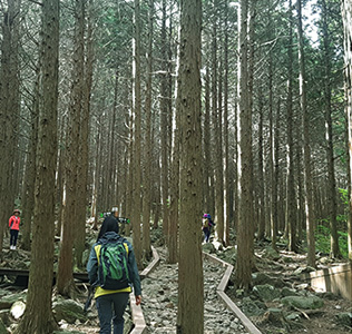
Mt. Illim (664 m) is located between Ungchi-myeon and Hoecheon-myeon of Boseong County. Thirty-three million square meters of lush azaleas bloom on the mountain by the Yongchu Valley, where the Boseong River originates. Below the summit of Mt. Illim are 2 large valleys and a wetland. The water winding from the wetland through bedrock resembles a dragon ascending. The cedar trees between the valleys exude a distinct scent. The annual Mt. Illim Azalea Festival takes place in early May.
 Azalea Mountain God Ritual Ceremony
 Blooming Royal Azalea
 Mt. Illim Trail
 Mt. Illim is situated in the watershed area of the Honam Region just before the South Sea, near Mt. Jeam (779m) and Mt. Saja (666m). A bamboo and silver grass field at the top of the mountain offers majestic scenery. From the top, hikers can see the Honam Region from Mt. Saja to Mt. Jeam in the northwest, to Mt. Cheongwan (723m) in Jangheung County and to Mt. Mudeung (1,187m) in the far distance. The coastal road’s panoramic view stretches from from Deungnyangman Bay to Yulpo Beach, then to the coast of Anyangmyeon in Jangheung County to the southeastern direction and Boseongman Bay.
The trail is rather simple, starting from Hanchi, on the border between Hoecheon-myeon and Ungchi-myeon. Hikers climb down from Illimsa Temple into the tea fields, walk through Hyeseong Bird Garden and then enter the grounds of Seacho Elementary School at Geumcheon.
The hiking course connecting Mt. Jeam and Beacon Fire Station can be completed in about 3 hours.
There are many tea fields near the Mt. Illim area, which grow about 40% of the Korean national tea yield.
Many pansori masters came from Dogang (the origin of Seopyeonje) and Youngcheon Village at the base of the mountain.

 Entrance to Yongchu Valley
 Cypress Forest
 Hillside
 Stairs around Peak
A legend about the pool at the bottom of Yongchu Waterfalls says even a spool of silk thread is too short to reach the bottom. Another legend is that if a childless woman throws a stone from Yong Rock on top of the pool into Yongchu Waterfalls, her prayer for a child will be answered.

